| Name | Last modified | Size | Description | |
|---|---|---|---|---|
| Parent Directory | - | |||
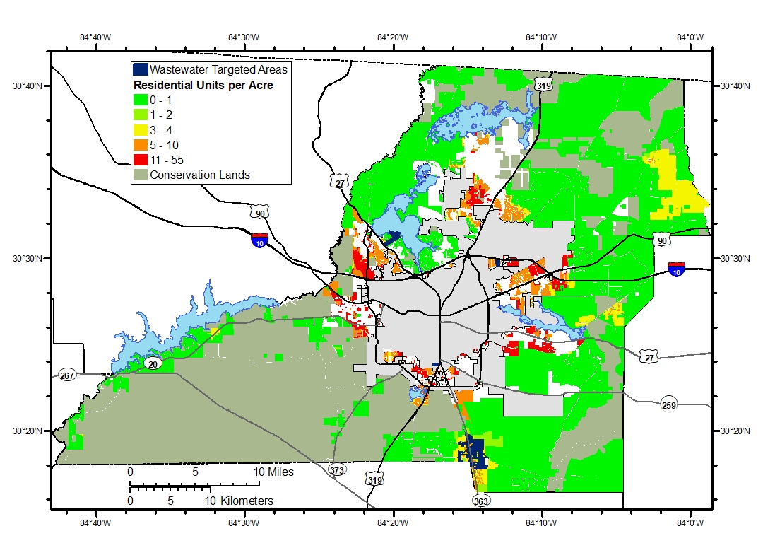
| Fig3_OSTDS_Residenti..> | 2020-04-03 14:56 | 449K | ||
| Fig3_OSTDS_Residenti..> | 2020-04-03 14:33 | 438K | ||
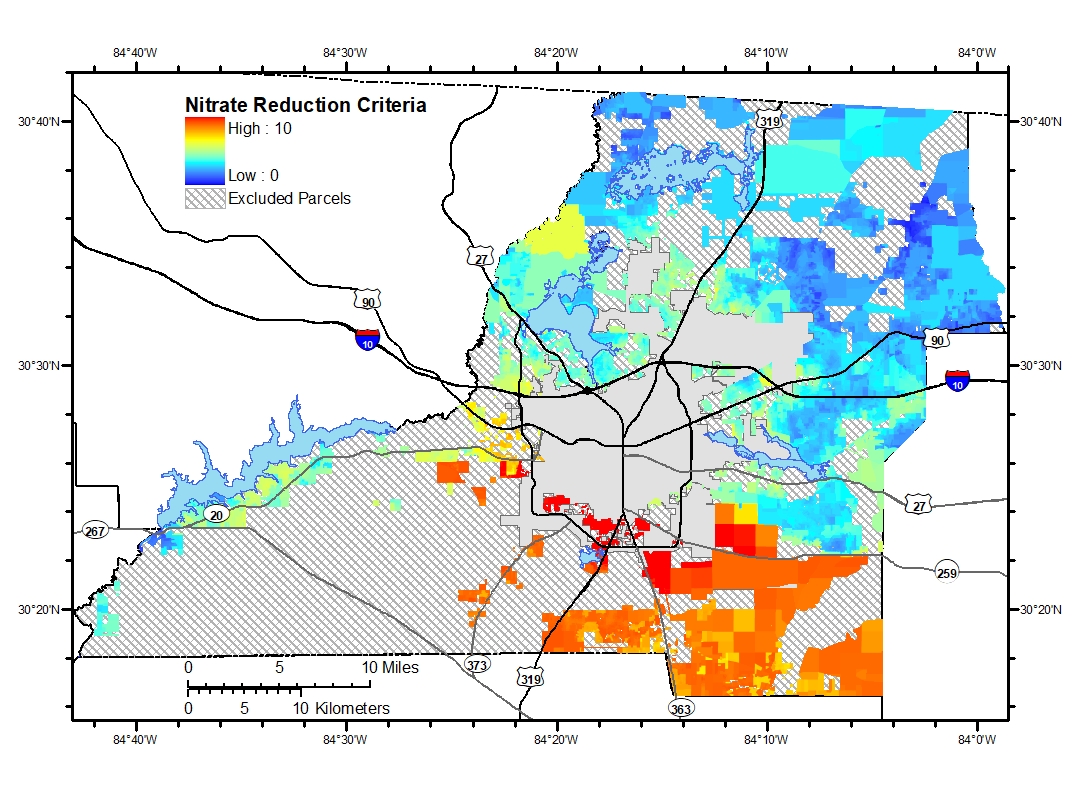
| Fig13_Nitrate reduct..> | 2020-04-03 11:19 | 540K | ||
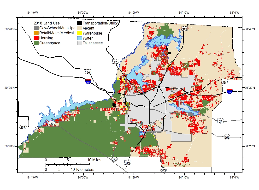
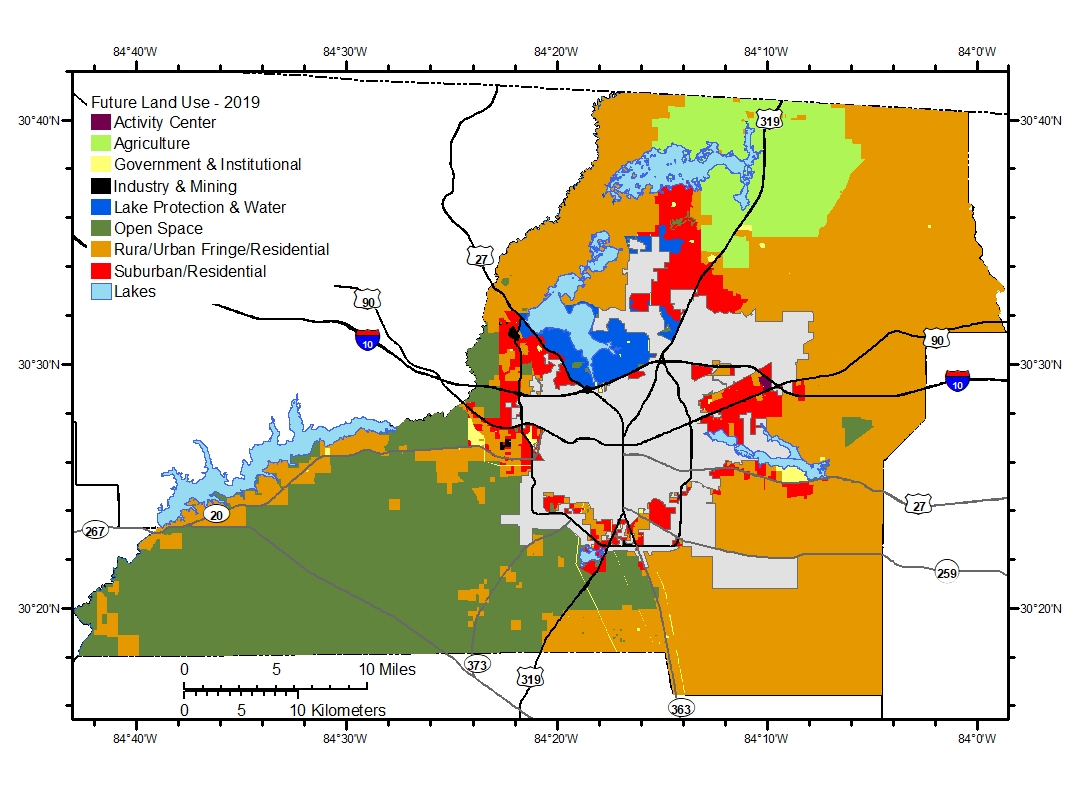
| Fig6_2018 Land Use.jpg | 2020-04-03 11:19 | 466K | ||
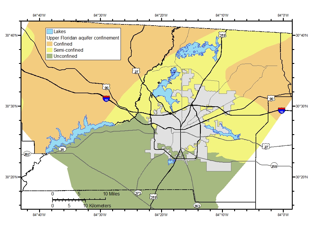
| Fig9_upr_fldn_confin..> | 2020-04-03 11:19 | 359K | ||
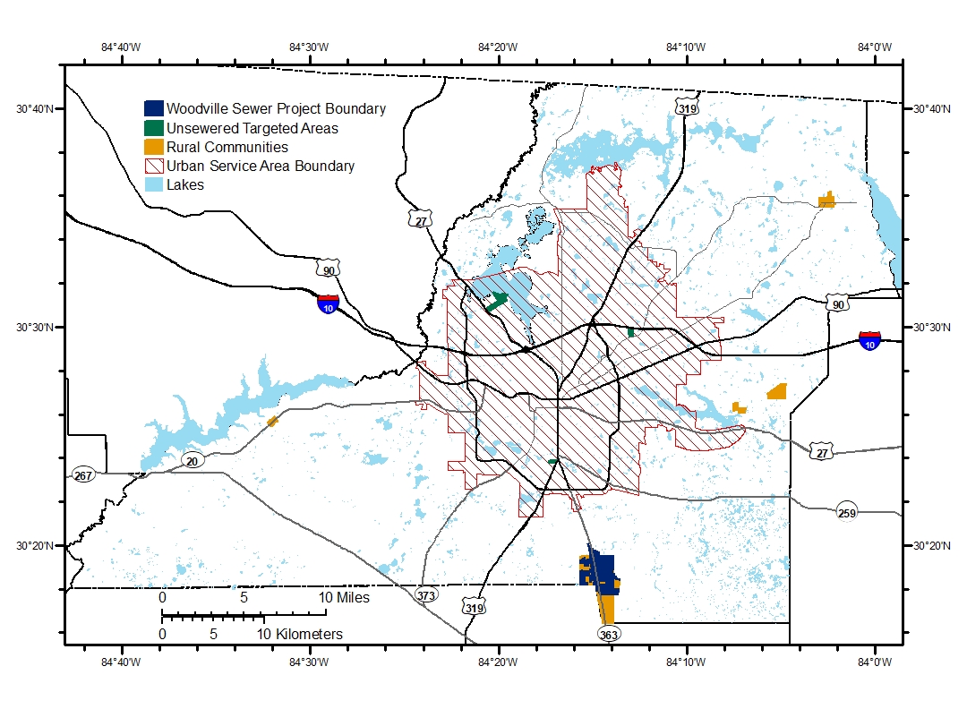
| Fig12_rural_comm_urb..> | 2020-04-01 20:09 | 514K | ||
| Fig7_Built out Land ..> | 2020-04-01 19:25 | 371K | ||
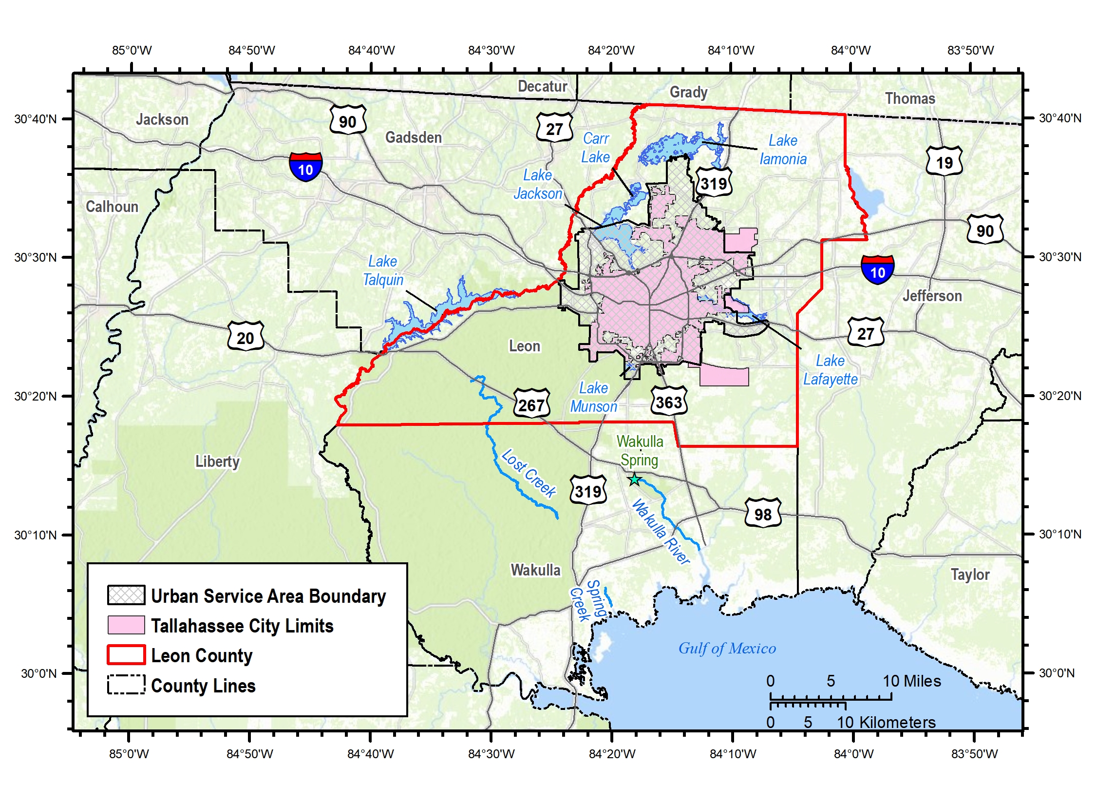
| Figure 1 20200401 v2..> | 2020-04-01 19:25 | 1.6M | ||
| Figure 4 20200401 v2..> | 2020-04-01 19:24 | 1.2M | ||
| Fig11_Existing Site ..> | 2020-03-31 21:53 | 609K | ||
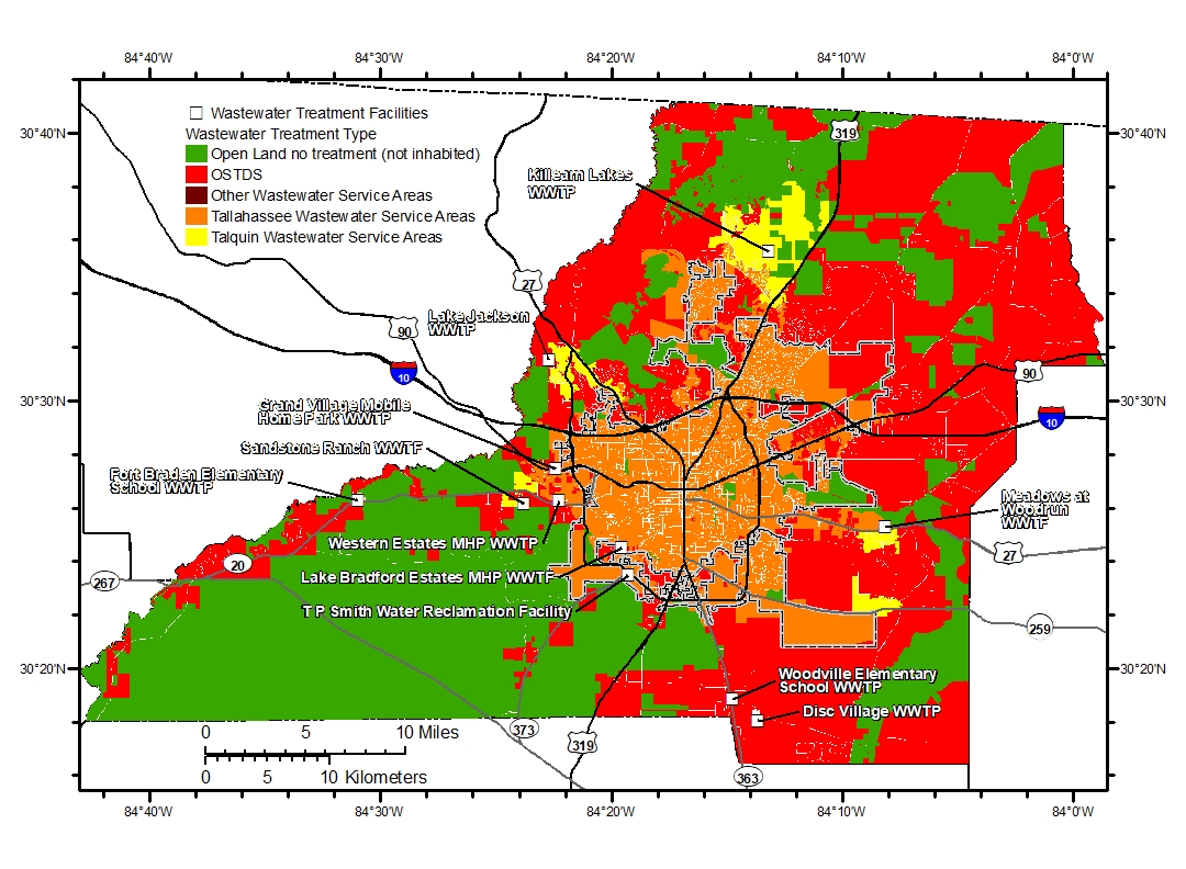
| Fig2_Current_treatme..> | 2020-03-24 22:35 | 560K | ||
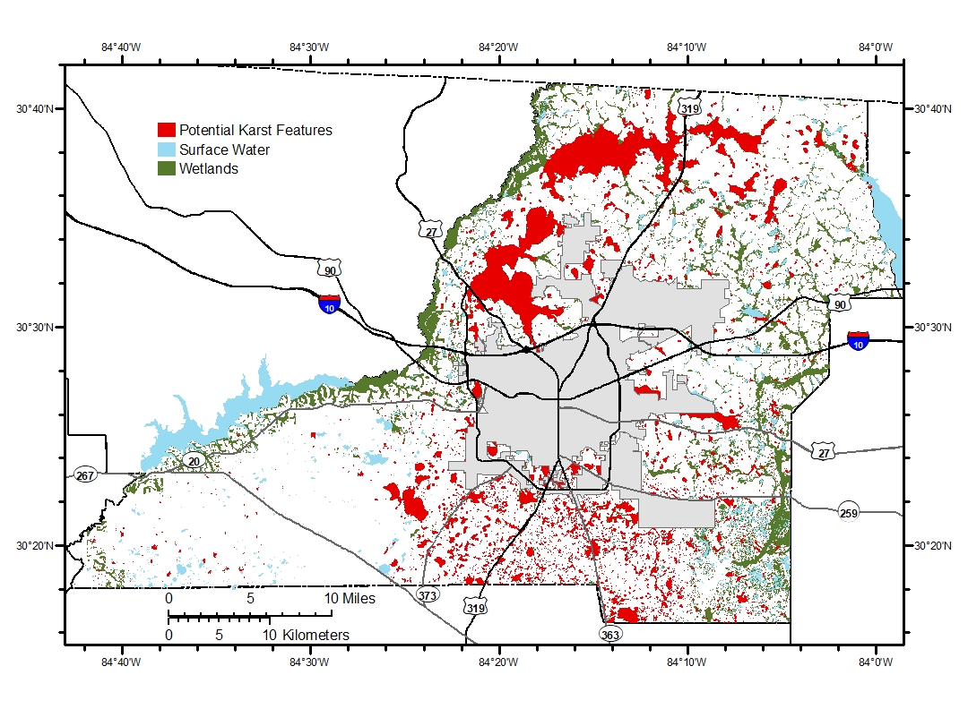
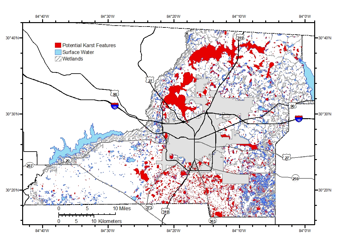
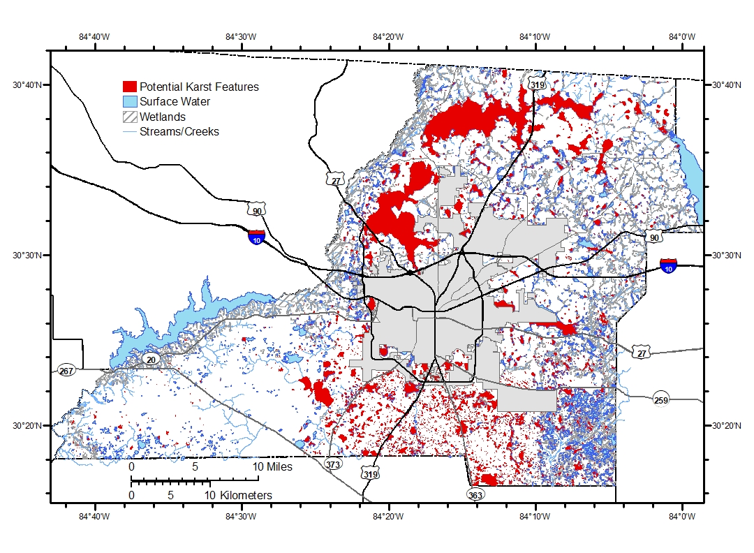
| Fig10_Karst_Areas.jpg | 2020-03-04 20:30 | 603K | ||
| Fig10_Karst_Areas_w_..> | 2020-03-04 20:00 | 626K | ||
| Fig10_Karst_Areas_w_..> | 2020-03-04 19:58 | 659K | ||
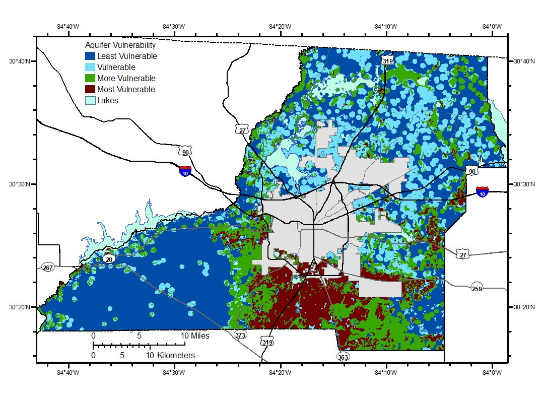
| Fig8_Leon_AqVulAsses..> | 2020-03-04 14:27 | 578K | ||
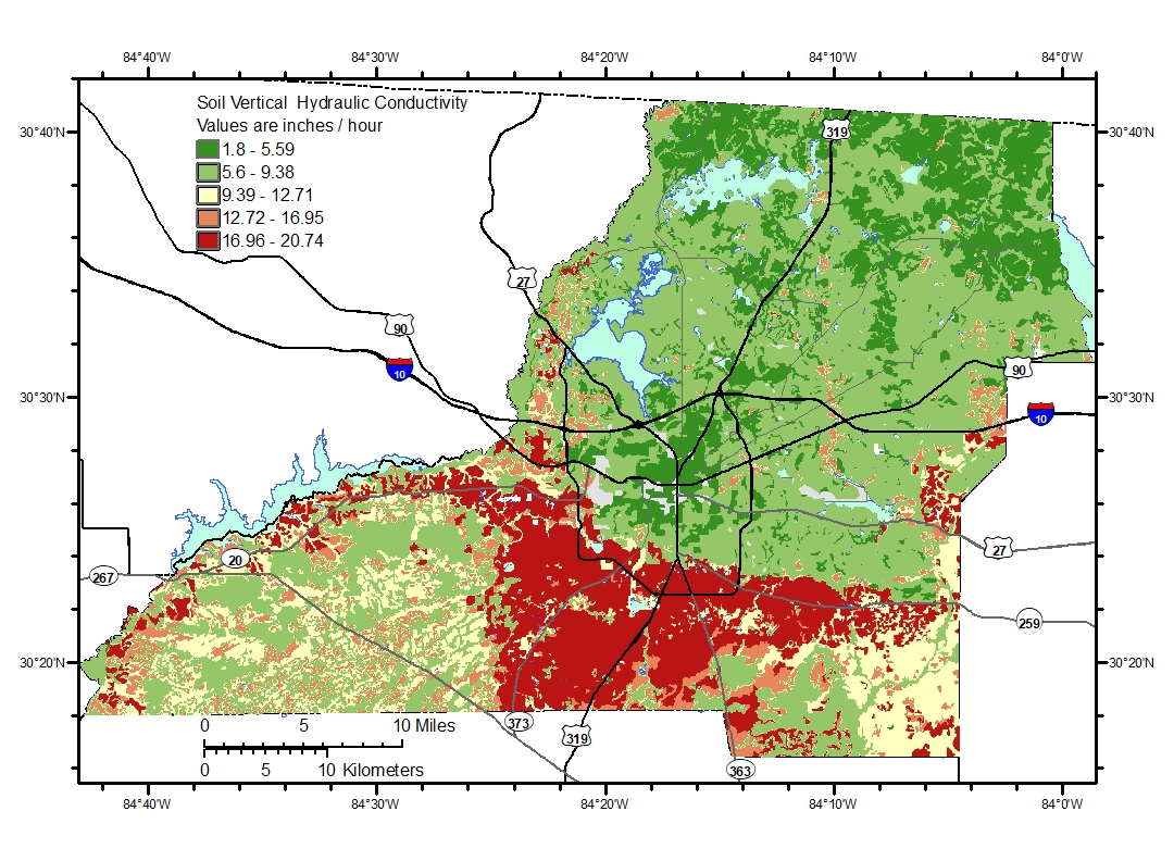
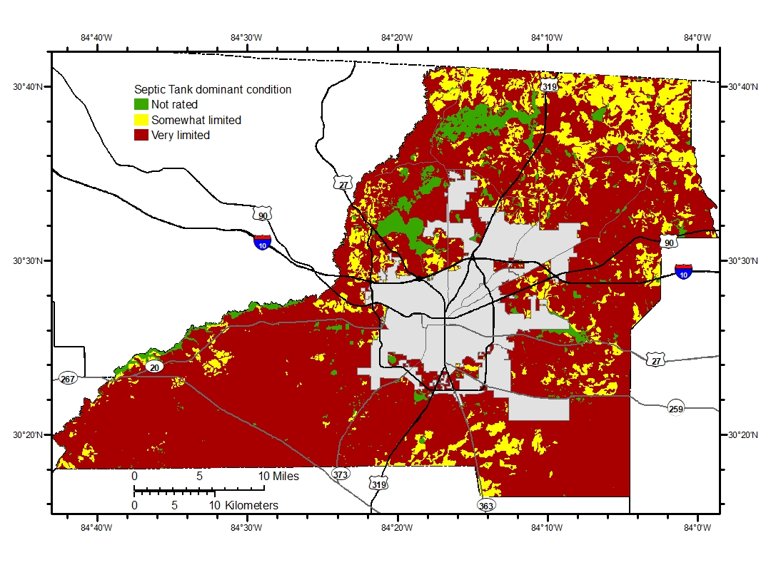
| Fig5_Soils OSTDS Sui..> | 2020-03-04 13:16 | 504K | ||
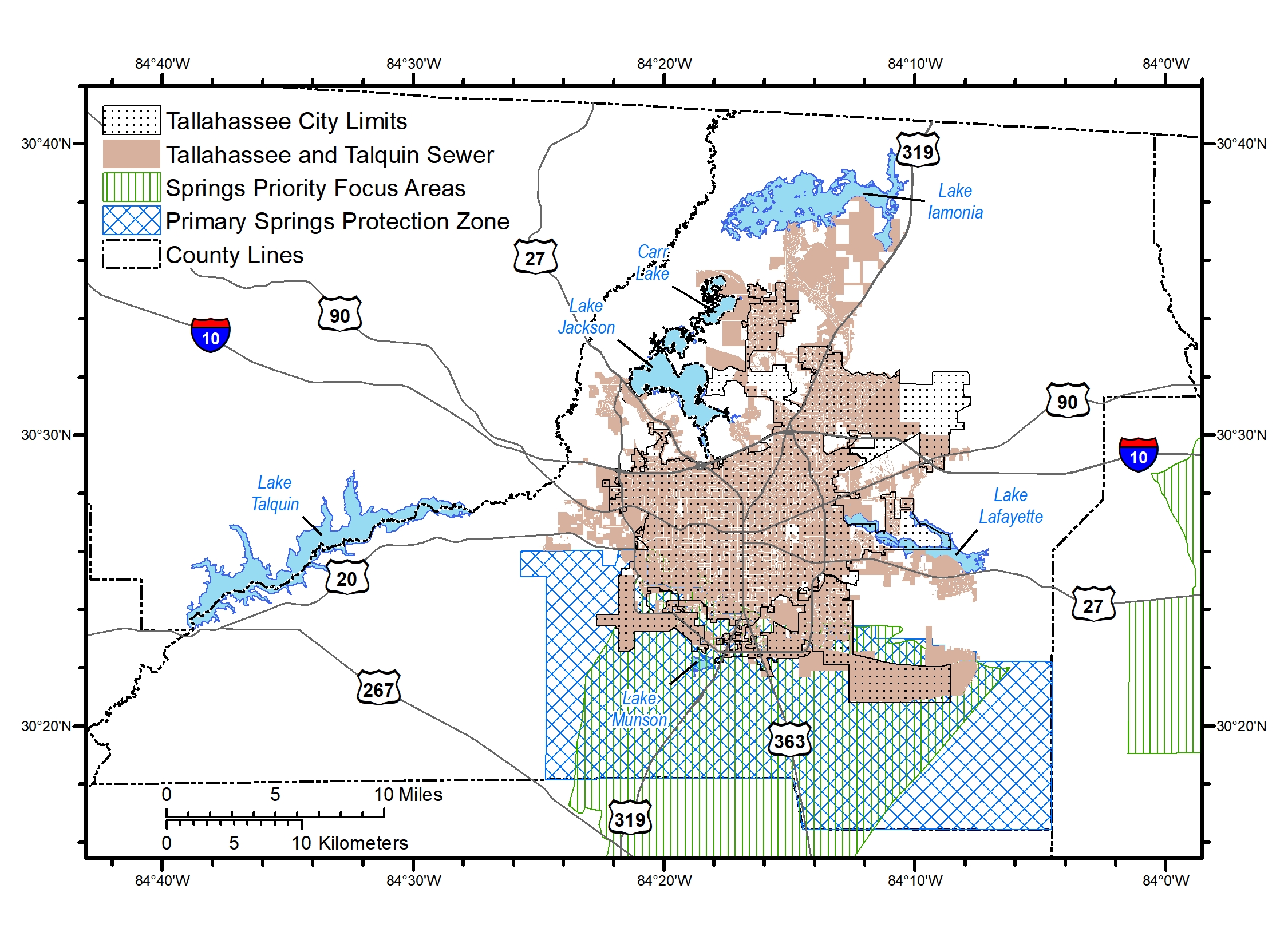
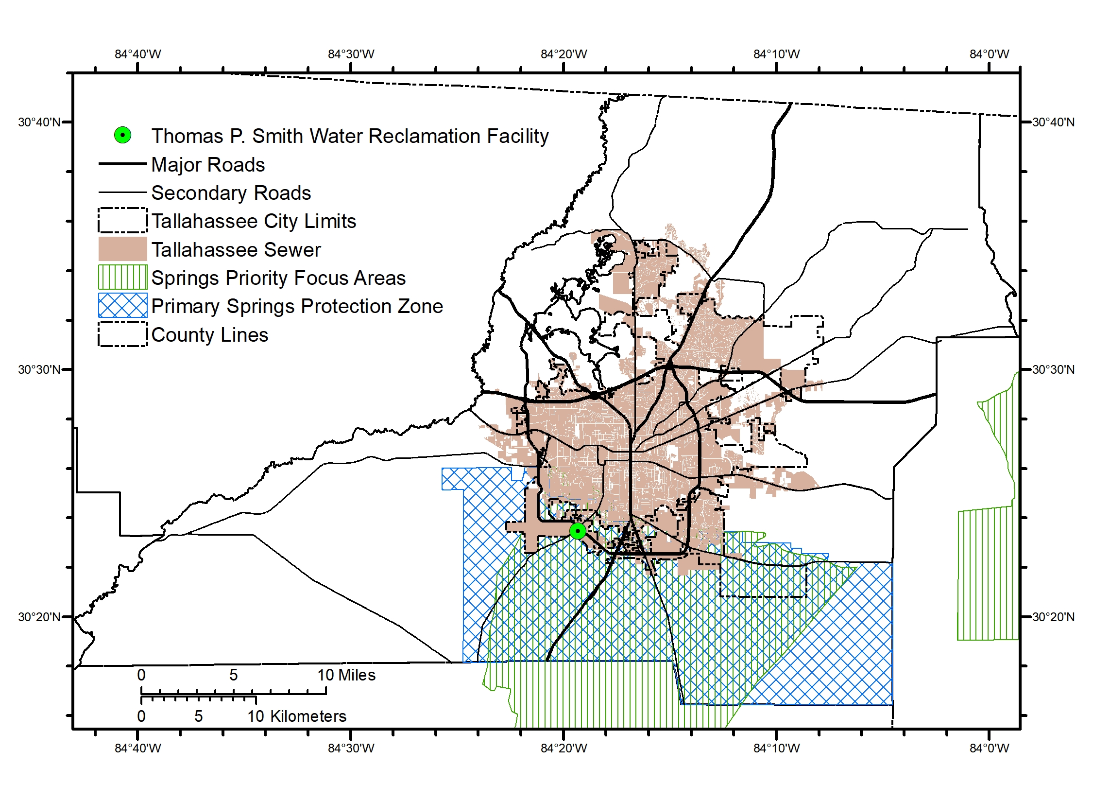
| Fig_4_Springs Protec..> | 2020-03-01 09:34 | 1.4M | ||
| Notes on Figures.docx | 2020-03-01 09:33 | 463K | ||